Beyond Construction: The Digital Thread Powering Infrastructure Lifecycles
A complete lifecycle solution. We connect the dots between Planning, Smart Construction Monitoring, and long-term Asset Maintenance using DeepTech, LLM and AI
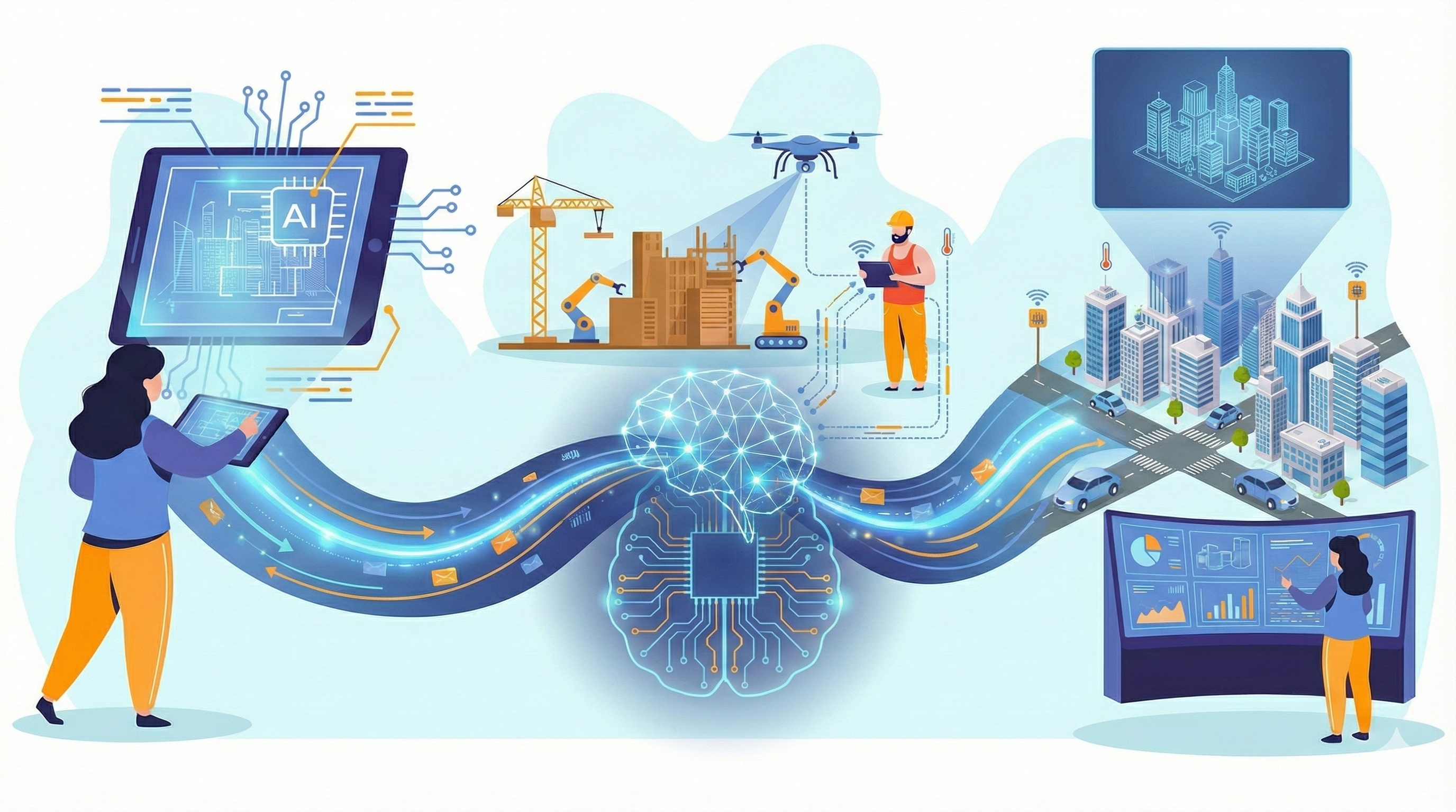
A complete lifecycle solution. We connect the dots between Planning, Smart Construction Monitoring, and long-term Asset Maintenance using DeepTech, LLM and AI
Seamless integration from concept to operation.
AI-driven DPR generation, feasibility surveys, and initial resource visualization. We turn static data into dynamic planning insights.
Real-time progress tracking, safety compliance, and material audits. We replace manual reporting with automated, truth-based analytics.
Predictive maintenance, digital asset inspection, and longevity planning. We extend asset life through proactive defect detection.
We orchestrate a symphony of hardware sensors and advanced AI models to create a digital nervous system for your assets.
Conversational interfaces that allow you to "talk" to your project data for complex queries and report generation.
Autonomous data capture from the air using drones and manned aircraft for large-scale precision mapping.
Real-time virtual replicas that allow for scenario simulation, stress testing, and historical playback.
A comprehensive ecosystem of hardware and AI.
Simulate, Predict, Optimize
Create dynamic virtual replicas of physical assets. By integrating sensor data into 3D models, we allow you to visualize the past, monitor the present, and simulate the future.
Learn morePrecision from the Sky
Our fleet of enterprise aerial platforms captures data from hard-to-reach vantage points with millimeter-level accuracy.
Learn moreCapturing Reality in 3D
Light Detection and Ranging (LiDAR) allows us to penetrate vegetation and capture complex geometries. We generate dense point clouds to model the world with sub-centimeter accuracy.
Learn moreVisual Intelligence
GSI transforms standard CCTV feeds into proactive security tools. We analyze video in real-time to prevent accidents before they occur.
Learn moreThe Brain Behind the Operation
We leverage Large Language Models (LLMs) and autonomous AI Agents to synthesize unstructured data (PDFs, logs, emails) into actionable insights.
Learn moreIntelligent Road Intelligence on the Move
Our AI-enabled Dashcams are edge-computing nodes designed for vehicle mounting. They capture road conditions, traffic violations, and asset inventory in real-time, processing data locally to minimize bandwidth usage.
Learn moreReal-time Data Acquisition
Deploy smart sensors for real-time monitoring of structural health, environmental quality, and asset performance.
Learn moreSolving complex challenges in Project Planning, Construction monitoring and Maintenance
A seamless digital thread connecting Planning, Construction, and O&M.
Phase 1: Use Agentic AI to query historical data and generate DPR.
Phase 2: Monitor daily progress using Mobile Apps and Drones.
Phase 3: Transition to O&M with Digital Twins.
Conversational Data Analytics. Data Aggregation from all sensors/apps. Natural Language Query. Instant Visualization. Eliminate manual reporting hours.
Learn moreReal-Time Planned vs. Actual Analysis & 4D Tracking. Aerial Intelligence, Ground Intelligence, AI Analysis, and Resource Tracking.
Learn moreThe 24/7 AI Safety Officer. PPE Detection, Zone Control, Fire/Smoke Safety detection, and height-work safety monitoring.
Learn moreVirtual Replicas for Predictive Insight. High-fidelity replicas of assets combined with live data feed to simulate scenarios.
Learn moreUnified Asset Mapping. Road & Highway, Bridge, T&D Lines, Track, and ULB interrogation.
Learn moreComprehensive Sky-Based Sensing. Drone Based Photogrammetry, LIDAR Survey, Airborne LiDAR.
Learn MoreEnd-to-end services that combine technical design, geospatial analysis, cost estimation, and regulatory compliance.
Learn MoreIndependent Third-Party Monitoring. Progress Audits, Dashboarding, Delay Analysis, Quality Audits.
Learn MoreCustom Digital Solutions. Custom GIS Platforms, Digital Twin Development, AI Solutioning.
Learn MoreHydrographic Mapping. Reservoir Capacity estimation, River Profiling, Dredging Support.
Learn MoreModernizing Track Infrastructure
Digital Twin of stations/tracks, Smart Inspection of Track/OHE.
Learn moreSmart Road Management
Smart Inspection via Dashcam, Digital Twin for corridor visualization.
Learn moreResource Management
Digital Twin for Flood simulation and Reservoir modeling.
Learn moreEfficient & Safe Extraction
Environmental Monitoring with automated suppression, Digital Twin for mine simulation.
Learn moreGrid Reliability
Smart Inspection of T&D corridors, Thermal Inspection of insulators.
Learn moreAsset Integrity & Safety
Smart Safety & HSE for hazard detection, Digital Twin for refinery simulation.
Learn moreConstruction
Challenge: Persistent delays in earthwork.
Outcome: Recovered 3 Months of lost time.
Deployed Drones for weekly volumetric analysis and LLM-based DPR generation.
Mining
Challenge: High PM10 levels.
Outcome: 100% Compliance.
Integrated PM sensors with Mist Cannons for automated suppression.
Smart City
Challenge: Lack of updated data.
Outcome: 60% Faster Repairs.
LiDAR mapping combined with Dashcam surveys created a comprehensive digital asset registry.
"To become the global interface where physical reality meets digital intelligence, creating a safer, cleaner, and more efficient world for future generations."
We believe data is only as good as its accuracy. We strive for millimeter-level perfection.
Technology must serve the environment. We optimize resources to reduce carbon footprints.
Pushing the boundaries of AI and IoT. We don't just use tools; we invent them.
sales@geosparrow.com
Noida, India